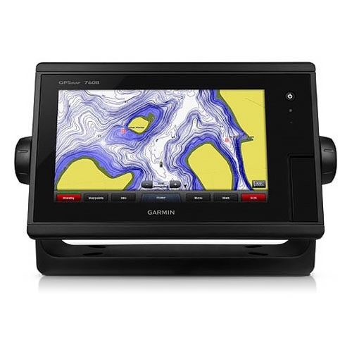
New Garmin Gpsmap 7608xsv Chartplotter / Sonar Combo 010-01305-03 on 2040-parts.com
Ekaterinburg, RU, Russian Federation
|
Brand new! With box and manuals!
What is in the box? See photos. 8-inch Multi-touch Widescreen Chartplotter/Sonar Combo
Designed for sportfishermen, cruisers, sailors and sailing racers who demand high performance, ease of operation and feature integration in a chartplotter/sonar combo. The 8-inch multi-touch widescreen GPSMAP 7608xsv combo includes built-in dual CHIRP sonar plus CHIRP DownVü and CHIRP SideVü scanning sonar with the clearest images on the water. Its internal 10 Hz GPS updates your position and heading 10 times per second. GPSMAP 7608xsv is fully network capable, including Garmin Network and NMEA 2000, and offers the conveniences of built-in Wi-Fi® connectivity. Built-in Advanced Sonar CapabilitiesThe built-in sonar capabilities of the GPSMAP 7608xsv include 1 kW dual CHIRP sonar, the most sophisticated sonar technology available for the fishing and boating public. Dual CHIRP sonar provides amazingly clear target separation and definition because it puts even more energy onto the target than CHIRP. It gives you the ability to show low/high, med/high or low/med on the screen at the same time, enhancing your ability to distinguish between game fish and balls of bait fish. It also includes both CHIRP DownVü and CHIRP SideVü scanning sonar that provide nearly photographic sonar images of fish and structure that passes below and to the sides of your boat. Garmin DownVü and SideVü provide the clearest scanning sonar images on the water. Also supported are 50 kHz/200 kHz, 77 kHz/200 kHz and Minn Kota® and MotorGuide® trolling motor transducers (sold separately). GPSMAP also includes sonar-recording capability that coordinates the timing of the sonar return with your boat's position and saves digital information for playback on a computer using HomePort™ planning software. Preloaded BlueChart g2 mapsIn addition to basic charts, tidal stations, currents, depth contours, IALA symbols and included fishing charts, BlueChart g2 offers smooth transitioning between zoom levels and more seamless continuity across chart boundaries. You can customize your screens with Safety Shading that allows you to shade all depth contours shallower than your boat’s safe depth. Fishing charts emphasize bathymetric contours with less visual clutter on the display. And there’s also a choice of standard 2-D direct overhead or 3-D “over-the-bow” map views for easier chart reading and orientation. Preloaded LakeVü HD mapsThese highly detailed freshwater maps include 17,000+ U.S. lakes, rivers and reservoirs. Included in those are more than 5,700 HD lakes with 1-foot contours shoreline to shoreline; excellent detail of underwater features plus Safety Shading that allows you to designate a minimum depth; interstates, highways, general roads and bridges; designated fishing areas; and points of interest, such as docks, boat ramps, marinas and campgrounds. Garmin Marine Network and NMEA 2000 SupportFull-network compatibility allows you to add more capabilities to your boat. GPSMAP 7608xsv supports radar, autopilot, instruments, multiple screens, FUSION-Link, sensors, remote sonar modules, digital switching, thermal cameras, GRID rotary knob, joystick and keypad control, GXM™ 52 marine weather receiver and more. Add Array or Dome RadarYou can add your choice of Garmin marine radar, including our powerful xHD2 open array radars or xHD dome radars that pairs ease of use with advanced open array features. Network SharingGPSMAP 7608xsv allows you to share features with other compatible GPSMAP units, such as radar, GSD 24, GSD 25 and GSD 26 sonar modules, supplemental maps, and user data, including waypoints, routes and tracks. User data entered into 1 chartplotter can be automatically synced with other chartplotters in a network. Heading and Position Refreshed 10 Times Per SecondFast, responsive 10 Hz GPS/GLONASS refreshes your position and heading 10 times each second to make your movement on the screen more fluid. It makes dropping up to 5,000 accurate waypoints — and finding your way back to them — quick and easy. Upgrade with the Best Maps on the WaterTwo SD™ card slots provide expandable memory for accessory map purchases, such as LakeVü HD Ultra with Max Def Lakes or BlueChart g2 Vision that add Garmin patented Auto Guidance and other great features. FUSION-Link Entertainment SystemEnjoy the ability to control all compatible FUSION-Link-enabled audio systems directly from your compatible chartplotter display. Built-in Wi-Fi/ANT+™Built-in Wi-Fi/ANT for use with Garmin Helm™ and BlueChart Mobile. Special Sailing FeaturesSupported sailing features include laylines, enhanced wind rose, heading and course-over-ground lines, true wind data fields and tide/current/time slider. Gauge displays are designed to provide important need-to-know information at a glance, including true and apparent wind angle, set and drift, true or apparent wind speed, horizontal or vertical graphs, and a data bar with customizable data fields. Compatible with gWind™ TransducersGarmin gWind, gWind Wireless and gWind Race transducers feature twin-fin technology with 3-bladed propeller. Connect to the NMEA 2000 and compatible Garmin chartplotters via the GND™ 10 black box bridge. Black Box InterfaceThe GND 10 black box interface seamlessly integrates Nexus instruments and sensors with the Garmin family. It converts data between the Nexus network and NMEA 2000 to provide trouble-free compatibility between Nexus and Garmin products. View and Control Your Device from a Smartphone or TabletGarmin Helm allows you to view and control your compatible Garmin chartplotter from a compatible smartphone or tablet while providing enhanced situational awareness for the mariner. Easily switch between portrait and landscape mode to accommodate mounting preferences. When using an iPhone® or iPad®, you can even record a movie of your chartplotter screen to share with friends and family. Download from The App Store™ or Google Play™. Get Your Apple® Device Onboard with BlueChart MobileWith BlueChart Mobile, a free app downloaded from the App Store, you can plan marine routes on your iPad or iPhone then wirelessly transfer them to your boat’s compatible networked Garmin chartplotter. Even if you don’t have a Garmin chartplotter, you can still take advantage of the tremendous features of BlueChart on your Apple device. iPhone and iPad are trademarks of Apple Inc. App Store is a service mark of Apple Inc. Android and Google Play are trademarks of Google Inc. Wi-Fi is a registered trademark of the Wi-Fi Alliance. Get Your Apple® Device Onboard with BlueChart MobileWith BlueChart Mobile, a free app downloaded from the App Store, you can plan marine routes on your iPad or iPhone then wirelessly transfer them to your boat’s compatible networked Garmin chartplotter. Even if you don’t have a Garmin chartplotter, you can still take advantage of the tremendous features of BlueChart on your Apple device. Enhanced Auto GuidanceJust enter the location where you want to go and patented Garmin Auto Guidance technology instantly searches through relevant charts to create a safe virtual pathway on the display that helps you avoid low bridges, shallow water and other charted obstructions en route. Better still, with enhanced Version 2.0, you now have access to even more features and capabilities. You’re able to adjust the calculated Auto Guidance pathway by inserting “via” points at interim stops or landmarks along your desired route. You can easily review hazard points along your calculated path. And you can even engage your compatible Garmin autopilot to follow the Auto Guidance route, automatically. Other 2.0 enhancements give you the ability to calculate arrival times at any point on your route (great for timing arrivals to correspond with bridge openings and other time-critical events). Better still, you can now save your plotted Auto Guidance paths for future navigation by backing them up on an SD™ card with your BlueChart® g2 Vision® or Garmin LakeVü™ HD Ultra cartography¹. Simplified SOS CallingThis exclusive SOS safety assist feature makes it easier for anyone – even those not familiar with marine electronics or radio protocols – to quickly call for Coast Guard help in an emergency. By simply tapping the SOS button on the chartplotter’s touchscreen display, your networked Garmin VHF radio will automatically tune to the Channel 16 emergency frequency and a list of possible situations (fire, man overboard, etc.) will be displayed. Once the applicable choice has been selected, the screen will provide a Coast Guard approved VHF radio distress call script, along with the ship’s current lat/long GPS coordinates, that can be read off to responders – thus saving time, averting panic, and providing the essential information needed by rescuers to assure the best possible outcome. GPX Waypoints TransferIf you have waypoints, tracks or frequently used routes stored on another manufacturer’s GPS product – or on a Garmin handheld device – now it’s easier than ever to transfer those items to your new Garmin chartplotter, via industry-standard GPX software formatting. GPX is an open standard format for GPS data exchange across platforms and applications. With this easy-to-use interface technology, Garmin has taken “no waypoint left behind” to a whole new level of trade-up convenience. Special Sailing FeaturesTo help you gain a wind-maximizing competitive edge, your chartplotter features a pre-race guidance page that shows your virtual starting line, along with data fields showing laylines, time to burn before the start and a race timer that can be synchronized across all your networked Garmin GPS products. In addition, other supported sailing features include an enhanced wind rose, heading and course-over-ground lines, set and drift, true and apparent wind data and more. You can also use available built-in wireless connectivity to access and control a variety of marine-specific apps via compatible smartphones or tablets. Panoptix™ Down TransducerWith 1 Panoptix Down transducer, you get 3 remarkable views, allowing you to actually see fish and bait swimming around under your boat – in real time. You can even see fish in the water column in 3-D, from the bottom to the surface. You can be stationary yet still see things in 3-D below your boat.
LIVEVÜ DOWNShows real-time moving sonar images below the boat. This screen shows bait drop echo trail movement in purple with sonar history data at left.
REALVÜ 3-D DOWNScans the area below the boat from front to back and side to side. This screen shows a school of fish sitting against the back side of vertical face, on Pport side of boat 35 feet deep.
REALVÜ 3-D HISTORICALScrolls through the data as the boat moves to show the history of entire water columns – from the bottom to the surface and all of the fish in between. This screen shows the boat passing over a stream channel with a school of fish between 30 to 40 feet. Panoptix Forward TransducerOne Panoptix Forward transducer provides 2 impressive views, even while your boat is stationary. It shows the bottom plus fish and bait swimming in the water column in front of your boat – in real time. You can even see your lure as you reel it in. You can also get 3-D views of fish and structure in front of your boat.
LIVEVÜ FORWARDUpdates are provided with a single ping, providing real-time moving images of what’s in the water. This screen shows a large target (a diver) approaching the boat.
REALVÜ 3-D FORWARDDigitally scans the area in front of the boat, creating a forward-looking 3-D view of the bottom, structure and fish. This screen shows fish targets at 10 feet and drawing bottom depth of 20 feet. Create your own HD mapsQuickdraw Contours is a free, easy-to-use software feature that is already installed on your compatible Garmin device. It instantly creates your very own personalized HD fishing maps with 1-foot contours. Tailor them to fit your needs. They are your maps. You own them. Keep the data to yourself or share it with Garmin or your friends. There’s no special surveying expertise required. You just fish while it creates maps. You don’t have to wait around or send your files away like other mapping software requires — your results appear instantly. Use with any Garmin Panoptix™, any HD-ID™, any CHIRP-enabled, Garmin DownVü™ transducer or NMEA 2000®-compatible depth transducer. Have more than 1 sonar device installed onboard? Quickdraw Contours automatically selects the most capable sonar device to provide the very best results for you!
Multiple Depth Range ShadingDesignate up to 10 different depth ranges each with its own color. Makes it easier to view target depths at a glance. Commission Autopilot from ChartplotterTo make commissioning easier and more convenient, you can handle the entire autopilot commissioning process from your chartplotter screen. Axis Camera SupportGarmin offers support for select Axis cameras, which can be used for surveillance and situational awareness on vessels of any size. Our integration allows you to view video on every screen on your boat and, if you wish, view multiple streams on the same screen. You can control your camera's pinch-to-zoom and pan/tilt settings with gestures directly on the plotter screen. Use an Axis encoder to convert analog camera, such as Garmin GC 10, to video over IP. iPhone and iPad are trademarks of Apple Inc., registered in the U.S. and other countries. App Store is a service mark of Apple Inc. Android and Google Play are trademarks of Google Inc.
Wi-Fi is a registered trademark of the Wi-Fi Alliance.
|


Fish Finders & Depth Finders for Sale
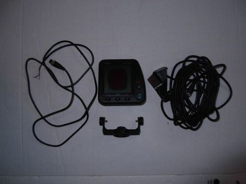 Fish finder horizon strike 220s(US $25.99)
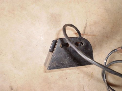 Transducers
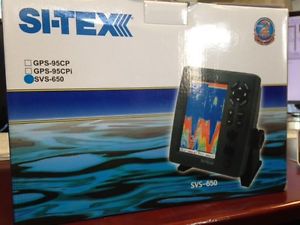 Sitex svs-650 depth sounder(US $425.00)
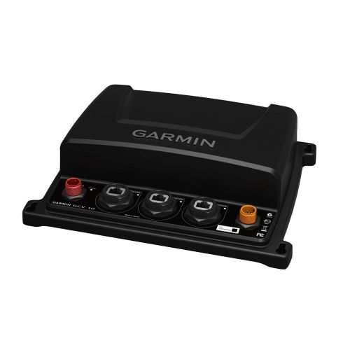 Garmin gcv 10 black box sonar mfg# 010-01156-00(US $585.88)
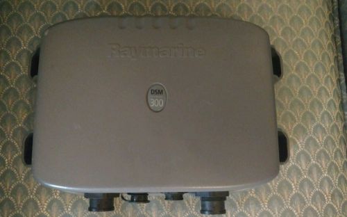 Raymarine dsm300 fish finder sounder module(US $175.00)
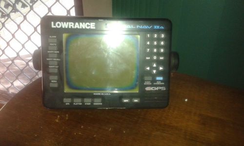 Lowrance gps(AU $500.00)
News watch March 2011: today's auto industry news
Thu, 31 Mar 2011Welcome to CAR Magazine's news aggregator as we round up the daily stories in the auto industry. Top tip: news summaries are added from the top hour-by-hour Thursday 31 March 2011• US President Barack Obama has strated all US government cars and trucks purchased from 2015 must be alternative-fuel vehicles (Automotive News)• Nissan CEO Carlos Ghosn has denied a report in Japan's Nikkei newspaper that he is leaning towards a formal merger of Nissan and Renault (Reuters)• Fiat CEO Sergio Marchionne says that Chrysler's share IPO may now take place in 2012, depending on financial progress this year (Bloomberg)Wednesday 30 March 2011• Tesla CEO Elon Musk has called a report that the EV carmaker is a takeover target 'bad analysis' and remains confident the firm will stay independent (Bloomberg)• The BBC denies that it rigged a December 2008 Top Gear TV test of the Tesla Roadster, in response to being sued by the EV carmaker (BBC News)• First Group, the UK's largest public transport operator, has announced a £160m investment in new buses, ordering 955 new buses from UK manufacturers Wrightbus and Dennis over the next two years (BBC News)• Japanese production woes look set to continue into April. Toyota expects the majority of Toyota and Lexus production on 14 April (Automotive News)• Saab production has re-started again, following a half yesterday afternoon.
Mercedes at 2013 Goodwood Festival of Speed – includes SLS AMG Black Series debut
Sat, 13 Jul 2013The Mercedes SLS AMG Black Series (pictured) debuts at 2013 Goodwood FoS In case you hadn’t noticed, it’s the Goodwood Festival of Speed this weekend and car makers are out in force with their fastest supercars and classics. Mercedes always offer a decent show at Goodwood and this year is no different, with the UK dynamic debut for the Mercedes SLS AMG Black Series, which will be strutting its stuff all weekend up the hillclimb. At the other end of the performance range, the Mercedes A45 AMG is also in action showing the crowds just what 360bhp in a compact hatch can do with its runs up the hillclimb.
New BMW Zagato Concept teased for Pebble Beach
Thu, 16 Aug 2012A surprise new BMW Zagato Roadster Concept is teased ahead of a debut at Pebble Beach later this month. Following on from the BMW Zagato Coupe we saw at Villa D’Este earlier this year, BMW are now teasing what appears to be a Roadster version ahead of a debut at Pebble Beach later this month. A one-off collaboration between BMW and Zagato at Villa D’Este is one thing, but to follow that up a few months later with a Roadster version makes us think the protestations that the Villa D’Este car was a one-off were a tad disingenuous.