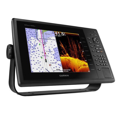
10-inch Keyed Chartplotter/Sonar Combo for Cruising, Sailing or Fishing
- Keyed chartplotter/sonar combo with 10-inch color SVGA display
- Preloaded U.S. LakeVü HD and BlueChart® g2 coastal maps
- High-sensitivity internal 10 Hz GPS/GLONASS receiver
- Built-in Garmin HD-ID™ 1 kW sonar, CHIRP and DownVü™ scanning sonar with CHIRP technology
- Supports all Garmin marine radars
The GPSMAP 1040xs keyed chartplotter/sonar combo has a
10-inch color SVGA display and comes with preloaded U.S. LakeVü HD and
BlueChart g2 coastal maps. HD-ID 1 kW sonar, CHIRP and DownVü with CHIRP
sonar technology are built-in, allowing you the flexibility to choose
from several optional transducers. It also provides media integration
and autopilot compatibility, radar support, and NMEA 2000® and wireless
connectivity.
Extreme Sonar Capabilities
The built-in sonar capabilities of the GPSMAP 1040xs gives you the
freedom and flexibility to choose from several optional transducers,
including traditional, CHIRP and all-in-one HD-ID/DownVü scanning sonar with CHIRP technology. Add a GCV™ 10 scanning sonar module for both DownVü and SideVü scanning sonar with CHIRP technology (sold separately).
Allow networked combos to share their internal sonar with any other
device on the network. GPSMAP 820xs also gives you the flexibility to
choose what information is overlaid on the sonar screen. For example,
time of day or GPS speed.
It also includes sonar-recording capability that coordinates the
timing of the sonar return with your boat's position and saves digital
information for playback on a computer using HomePort™ planning software
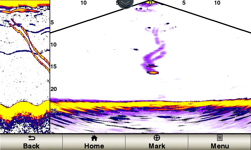
CHIRP Support
When used with a compatible CHIRP transducer (sold separately),
GPSMAP 1040xs displays crystal-clear sonar images detailing fishing hot
spots, ship wreckage or a diving location. With Garmin CHIRP technology,
you get remarkable target separation and resolution at extraordinary
depths, and can dial into specific frequencies to target certain species
of sport fish. Bottom contours are more visible, even at speed, and
signal noise can be suppressed at greater depths to provide a more
timely interpretation of what’s below for safer navigation and better
fishing.
Dynamic Sea Temperature
Set a range for sea temperatures, and it dynamically adjusts to
display a color range that can be used to target certain types of fish
(Optional GXM™ 52 required).
Radar Support
Add your choice of marine radar, either open array or our new xHD
dome radar that pair ease of use with advanced open array features.
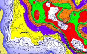
Preloaded LakeVü HD Maps
These highly detailed freshwater maps include 17,000+ U.S. lakes,
rivers and reservoirs. Included in those are more than 13,000 HD lakes
with 1-foot contours shoreline to shoreline; excellent detail of
underwater features plus Shallow Water Shading that allows you to
designate a minimum depth; interstates, highways, general roads and
bridges; designated fishing areas; and points of interest, such as
docks, boat ramps, marinas and campgrounds.
Super-fast 10 Hz GPS/GLONASS
High-sensitivity internal 10 Hz GPS/GLONASS provides position and
heading updates 10 times per second. It displays fluid on-screen
location and proves to be incredibly accurate when marking waypoints and
navigating.
NMEA 2000 Support
This combo allows you to add more capabilities to your boat. It
provides NMEA 2000 support so you can see valuable information on your
screen for Garmin autopilot, engine data, SiriusXM Weather radar and
more.
Networking
The GPSMAP 1040xs offers select networking capabilities that allow
you to share features with other compatible GPSMAP units, such as radar,
GCV 10
DownVü and SideVü scanning sonar, supplemental maps, and user data,
including waypoints, routes and tracks. User data entered into 1
chartplotter can be automatically synced with other chartplotters in a
network.
Special Sailing Features
Supported sailing features include laylines, enhanced wind rose,
heading and course-over-ground lines, true wind data fields and
tide/current/time slider. Gauge displays are designed to provide
important need-to-know information at a glance, including true and
apparent wind angle, set and drift, true or apparent wind speed,
horizontal or vertical graphs, and a data bar with customizable data
fields.
GND™ 10 Black Box Interface
The GND 10 black box interface seamlessly integrates Nexus instruments and sensors
with the Garmin family. It converts data between the Nexus network and
NMEA 2000 to provide trouble-free compatibility between Nexus and Garmin
products, including gWind™ and gWind Race wind transducers.
Compatible with gWind Transducers
Garmin gWind, gWind Wireless and gWind Race transducers feature
twin-fin technology with 3-bladed propeller. Connect to the NMEA 2000
and compatible Garmin chartplotters via the GND 10 black box bridge.
FUSION-Link Entertainment System
Enjoy the ability to control all compatible FUSION-Link-enabled audio
systems directly from your compatible chartplotter display.
View and Control Your Device from a Smartphone or Tablet
Garmin Helm™
allows you to view and control your compatible Garmin chartplotter from
an iPhone® or iPad® or phone, or phone or tablet using Android — while
providing enhanced situational awareness for the mariner. Easily switch
between portrait and landscape mode to accommodate mounting preferences.
Using your iPhone or iPad, you can even record a movie of your
chartplotter screen to share with friends and family. Download from the
App Store™ or Google Play™ today.
Get Your Apple® Device Onboard with BlueChart® Mobile
With BlueChart Mobile,
a free app downloaded from the App Store, you can plan marine routes on
your iPad or iPhone then wirelessly transfer them to your boat’s
compatible networked Garmin chartplotter. Even if you don’t have a
Garmin chartplotter, you can still take advantage of the tremendous
features of BlueChart on your Apple device.
Enhanced Auto Guidance
Just enter the location where you want to go and patented Garmin Auto
Guidance technology instantly searches through relevant charts to
create a safe virtual pathway on the display that helps you avoid low
bridges, shallow water and other charted obstructions en route.
Better still, with enhanced Version 2.0, you now have access to even
more features and capabilities. You’re able to adjust the calculated
Auto Guidance pathway by inserting “via” points at interim stops or
landmarks along your desired route. You can easily review hazard points
along your calculated path. And you can even engage your compatible
Garmin autopilot to follow the Auto Guidance route, automatically. Other
2.0 enhancements give you the ability to calculate arrival times at any
point on your route (great for timing arrivals to correspond with
bridge openings and other time-critical events). Better still, you can
now save your plotted Auto Guidance paths for future navigation by
backing them up on an SD™ card with your BlueChart® g2 Vision® or Lake
Vü™ HD Ultra cartography¹.
GPX Waypoints Transfer
If you have waypoints, tracks or frequently used routes stored on
another manufacturer’s GPS product – or on a Garmin handheld device –
now it’s easier than ever to transfer those items to your new Garmin
chartplotter, via industry-standard GPX software formatting. GPX is an
open standard format for GPS data exchange across platforms and
applications. With this easy-to-use interface technology, Garmin has
taken “no waypoint left behind” to a whole new level of trade-up
convenience.
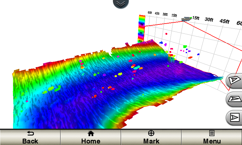
Panoptix™ Down Transducer
With 1 Panoptix Down transducer, you get 3 remarkable views, allowing
you to actually see fish and bait swimming around under your boat – in
real time. You can even see fish in the water column in 3-D, from the
bottom to the surface. You can be stationary yet still see things in 3-D
below your boat.
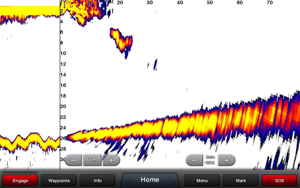
LIVEVÜ DOWN
Shows real-time moving sonar images below
the boat. This screen shows bait drop echo trail movement in purple with
sonar history data at left.
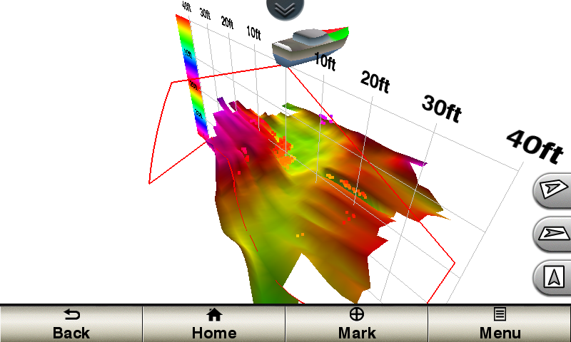
REALVÜ 3-D DOWN
Scans the area below the boat from front to
back and side to side. This screen shows a school of fish sitting
against the back side of vertical face, on Pport side of boat 35 feet
deep.
REALVÜ 3-D HISTORICAL
Scrolls through the data as the boat moves
to show the history of entire water columns – from the bottom to the
surface and all of the fish in between. This screen shows the boat
passing over a stream channel with a school of fish between 30 to 40
feet.
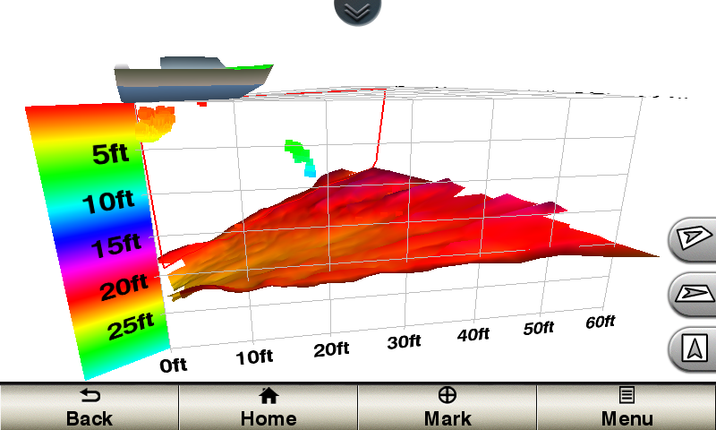
Panoptix Forward Transducer
One Panoptix Forward transducer provides 2 impressive views, even
while your boat is stationary. It shows the bottom plus fish and bait
swimming in the water column in front of your boat – in real time. You
can even see your lure as you reel it in. You can also get 3-D views of
fish and structure in front of your boat.
LIVEVÜ FORWARD
Updates are provided with a single ping,
providing real-time moving images of what’s in the water. This screen
shows a large target (a diver) approaching the boat.
REALVÜ 3-D FORWARD
Digitally scans the area in front of the
boat, creating a forward-looking 3-D view of the bottom, structure and
fish. This screen shows fish targets at 10 feet and drawing bottom depth
of 20 feet.
Create your own HD maps
Quickdraw Contours is a free, easy-to-use software feature that is
already installed on your compatible Garmin device. It instantly creates
your very own personalized HD fishing maps with 1-foot contours. Tailor
them to fit your needs. They are your maps. You own them. Keep the data
to yourself or share it with Garmin or your friends. There’s no special
surveying expertise required. You just fish while it creates maps. You
don’t have to wait around or send your files away like other mapping
software requires — your results appear instantly. Use with any Garmin
Panoptix™, any HD-ID™, any CHIRP-enabled, Garmin DownVü™ transducer or
NMEA 2000®-compatible depth transducer. Have more than 1 sonar device
installed onboard? Quickdraw Contours automatically selects the most
capable sonar device to provide the very best results for you!
Multiple Depth Range Shading
Designate up to 10 different depth ranges each with its own color. Makes it easier to view target depths at a glance.
iPhone and iPad are trademarks of Apple
Inc., registered in the U.S. and other countries. App Store is a service
mark of Apple Inc. Android and Google Play are trademarks of Google
Inc.
Wi-Fi is a registered trademark of the Wi-Fi Alliance.
1BlueChart® g2 Vision® or LakeVü™ HD Ultra SD card is required for this technology.


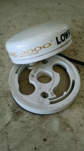 Lowrance lgc-3000 gps antenna(US $165.00)
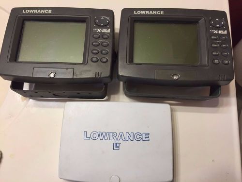 2 lowrance lcx-15mt fish graph fishfinder chart plotter gps(US $229.00)
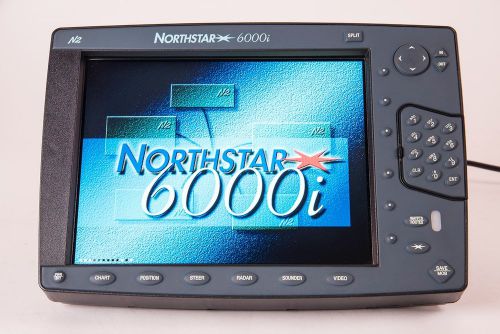 Northstar 6000i with 10” display(US $499.00)
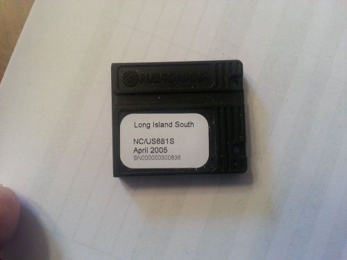 Navionics chart nc/us681s long island south for northstar gps(US $79.00)
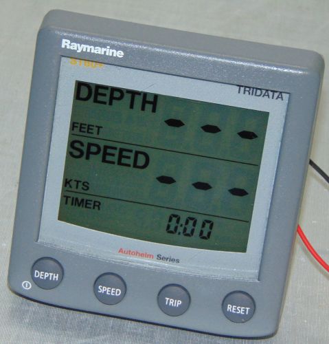 Raymarine st60+ tridata display a22004-p(US $300.00)
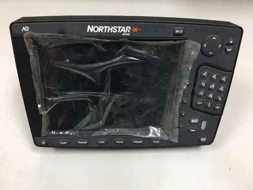 Northstar 6100i, 6.4" color multi-function display with antenna(US $499.95)