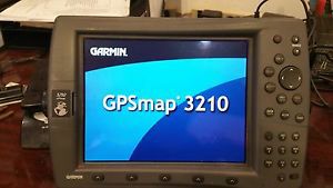
Garmin Gpsmap 3210 Chartplotter Gps Map 10.4" Color Screen With Preloaded Charts on 2040-parts.com
Marco Island, Florida, United States
|
Great condition navigation unit
Includes ONLY 3210 gsp with preloaded charts power cable Quick Reference Guide Sun Cover Data monitor Cable installation instructions If not flush mounting I can include a mounting bracket for $50.00 and used antenna for Extra $75.00 if needed Plug into the Garmin Marine Network with the GPSMAP 3210, a 10.4-inch color screen chartplotter with preloaded marine maps. Whether you choose the 3210 or its counterpart, the GPSMAP 3206, you’ll get bold, sunlight-readable color, high-speed processing and the versatility of a multifunction display. See Marine Maps Sharp DetailThe GPSMAP 3210 comes preloaded with U.S. marine detailed maps for the entire coast of the United States, including Alaska and Hawaii. These maps are based on BlueChart g2 technology, so they layer smoothly and are integrated for easy panning, scrolling and zooming. The maps also provide a choice between 3D "mariner's-eye-view", or the familiar 2D direct-overhead view to make chart reading and orientation easier. And, with the 3210's crisp 10.4-inch diagonal screen, you'll get incredible contrast and detailing, even in direct sunlight. Integrate Easily with Garmin Marine NetworkThe 3210 connects easily to the Garmin Marine Network, so you can interface with additional MFDs and add remote sensors and sonar. Its slim-line design makes it easy to install in cabin bulkheads or open cockpits. The 3210 also provides a remote control, VGA output and video input options, so you can connect a live video feed from your engine room or other area of the boat. Keep Tabs on the WeatherTough enough to withstand rain, sunlight and saltwater spray, the case is fully gasketed and water resistant to IPX7 standards. Better yet, with an optional subscription to XM WX Satellite Weather™ and the addition of a GDL 30 or 30A weather receiver, you can receive weather information for the U.S. You can see detailed weather patterns, including NEXRAD radar, right on the 3210's screen by connecting through the Garmin Marine Network. The GDL 30A also provides XM Satellite Radio service. Add More Marine MapsThe 3210 accepts optional BlueChart g2 marine cartography, which brings you 3D maps, tides and currents, depth contours, navaids, port plans, marine services and more.
|
||||||||||||||||||||||||||||||||||||||||||||||||||||||||||||||||||||||||
GPS & Chartplotters for Sale
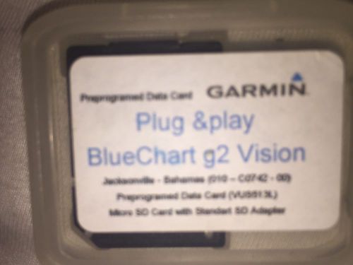 Garmin bluechart g2 vision vus513l for jacksonville - bahamas(US $75.00)
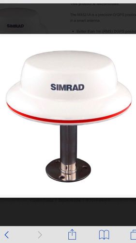 Simrad dgps antenna mx521b(US $699.00)
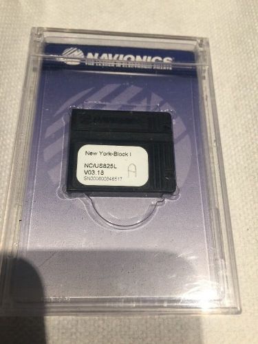 Navionics classic new york block island us825l v03.18 navchart(US $110.00)
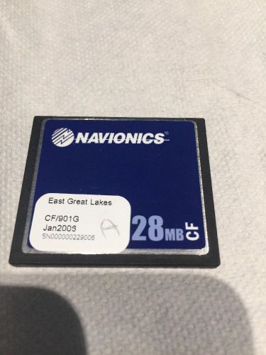 Navionics cf gold 901 g east great lakes gold card 2006(US $84.50)
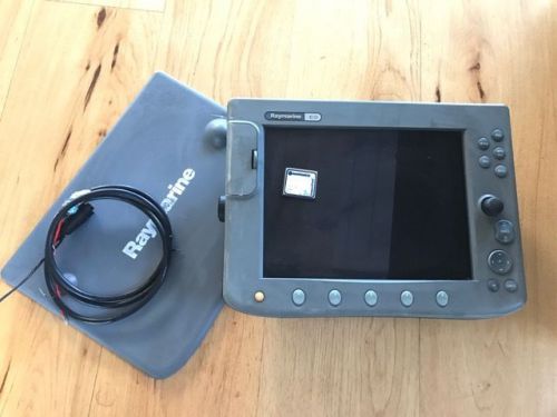 Raymarine c120 gps & chartplotter(US $500.00)
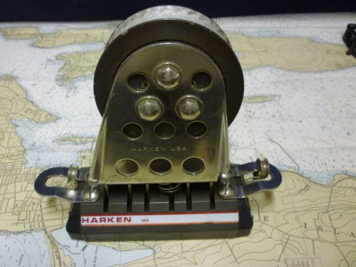 Harken big boat 1.25" genoa track lead adjustable
2014 World Car Awards shortlist announced
Wed, 12 Feb 2014The shortlist of finalists for the 2014 World Car Awards (WCAs) has been announced, revealing the cars that will compete for the 2014 World Car of the Year, as well as the World Luxury Car, the World Performance Car, the World Green Car and the World Car Design 2014 awards. MSN Cars’ very own Peter Burgess is amongst the 69 global motoring journalists who have whittled down the contenders in each of the categories – there are supposed to be 10 of each, but some tied results at this stage mean some of the awards have slightly more finalists this year. The next stage reduces the field down to three cars vying for each award.
2014 Chevy Corvette appears in Gran Turismo 5
Tue, 13 Nov 2012Information on the seventh-generation Chevy Corvette has been popping up in different places for months. First we saw the front end leaked by a supplier. Then we saw mules testing with C6 bodies.
Peugeot RCZ R to debut at 2013 Goodwood Festival of Speed
Mon, 10 Jun 2013The Peugeot RCZ R is the hottest version yet of the RCZ coupe and will make its world debut at the 2013 Goodwood Festival of Speed. The Audi TTS-rivalling RCZ R will be seen in both the static display and in high-speed action on the Goodwood hillclimb, ahead of UK deliveries kicking off in early 2014. What modifications turn a Peugeot RCZ into an RCZ R?