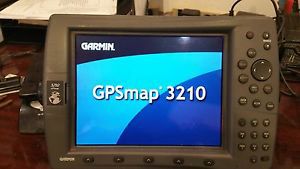
Garmin Gpsmap 3210 Chartplotter Gps Map 10.4" Color Screen With Preloaded Charts on 2040-parts.com
Marco Island, Florida, United States
|
Great condition navigation unit
Includes ONLY 3210 gsp with preloaded charts power cable Quick Reference Guide Sun Cover Data monitor Cable installation instructions If not flush mounting I can include a mounting bracket for $50.00 and used antenna for Extra $75.00 if needed Plug into the Garmin Marine Network with the GPSMAP 3210, a 10.4-inch color screen chartplotter with preloaded marine maps. Whether you choose the 3210 or its counterpart, the GPSMAP 3206, you’ll get bold, sunlight-readable color, high-speed processing and the versatility of a multifunction display. See Marine Maps Sharp DetailThe GPSMAP 3210 comes preloaded with U.S. marine detailed maps for the entire coast of the United States, including Alaska and Hawaii. These maps are based on BlueChart g2 technology, so they layer smoothly and are integrated for easy panning, scrolling and zooming. The maps also provide a choice between 3D "mariner's-eye-view", or the familiar 2D direct-overhead view to make chart reading and orientation easier. And, with the 3210's crisp 10.4-inch diagonal screen, you'll get incredible contrast and detailing, even in direct sunlight. Integrate Easily with Garmin Marine NetworkThe 3210 connects easily to the Garmin Marine Network, so you can interface with additional MFDs and add remote sensors and sonar. Its slim-line design makes it easy to install in cabin bulkheads or open cockpits. The 3210 also provides a remote control, VGA output and video input options, so you can connect a live video feed from your engine room or other area of the boat. Keep Tabs on the WeatherTough enough to withstand rain, sunlight and saltwater spray, the case is fully gasketed and water resistant to IPX7 standards. Better yet, with an optional subscription to XM WX Satellite Weather™ and the addition of a GDL 30 or 30A weather receiver, you can receive weather information for the U.S. You can see detailed weather patterns, including NEXRAD radar, right on the 3210's screen by connecting through the Garmin Marine Network. The GDL 30A also provides XM Satellite Radio service. Add More Marine MapsThe 3210 accepts optional BlueChart g2 marine cartography, which brings you 3D maps, tides and currents, depth contours, navaids, port plans, marine services and more.
|
||||||||||||||||||||||||||||||||||||||||||||||||||||||||||||||||||||||||
GPS & Chartplotters for Sale
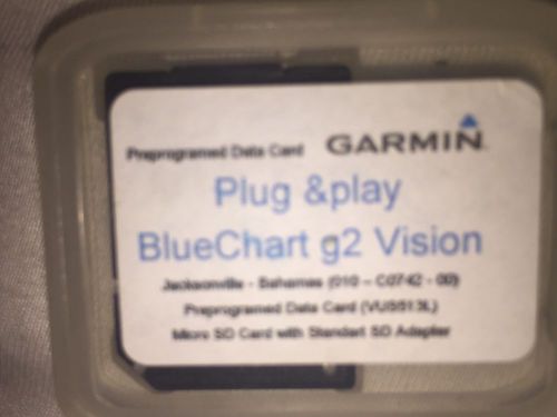 Garmin bluechart g2 vision vus513l for jacksonville - bahamas(US $75.00)
 Simrad dgps antenna mx521b(US $699.00)
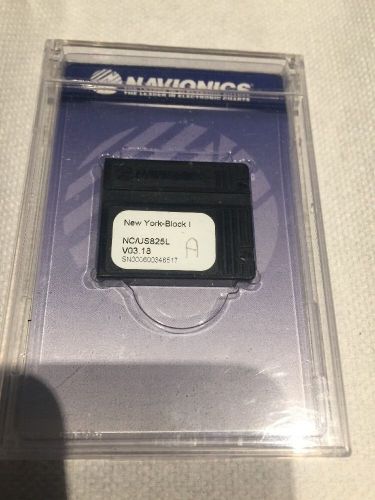 Navionics classic new york block island us825l v03.18 navchart(US $110.00)
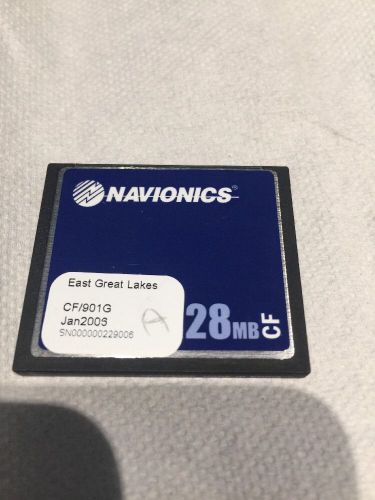 Navionics cf gold 901 g east great lakes gold card 2006(US $84.50)
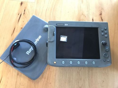 Raymarine c120 gps & chartplotter(US $500.00)
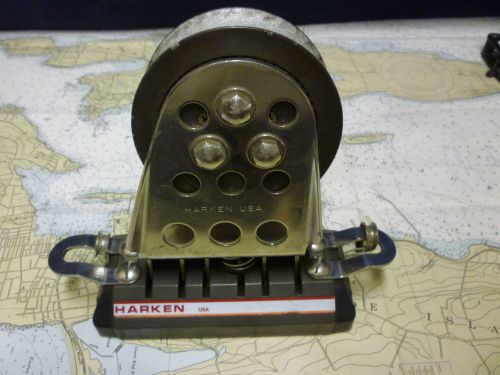 Harken big boat 1.25" genoa track lead adjustable
We like you, we just won't call you
Mon, 24 Aug 2009Trusty readers have alerted us that they are receiving phone calls from people who claim to work for AutoWeek. These callers don't. We've also heard that these telemarketers are nasty--cursing, name-calling, all-around crude behavior.
Reva NXR launched & Reva NXG revealed at Frankfurt
Thu, 17 Sep 2009The Reva NXG which has been revealed at Frankfurt The Reva NXR is the proper launch and will be available to order straight away with delivery starting in early 2010. The styling is still pretty unconvincing, but for a small city EV it’s probably acceptable. The NXR is a three-door, four seat hatchback with a range of around 100 miles per charge and a top speed of 65mph.
RM classic-car auction in Detroit rakes in more than $2.5 million
Wed, 28 Apr 2010Two of General Motors' finest convertibles from half a century ago were the top sellers at the RM auction last weekend in suburban Detroit. A 1958 Pontiac Parisienne droptop sold for $104,500, and a 1960 Cadillac Eldorado Biarritz went for $82,500 at the annual classic-car event, April 24-25 in Novi, Mich. Prices include a buyers premium.