Ecdis is an electronic charting system (ECS) for maritime use like :fishing boat,yacht,merchant ships,skipper,maritime pilot etc . The system makes use of vectorized marine charts from C-Map and offers a wide range of functions for navigation, route planning, safety, logging and data presentation.You can alternatively connect the AIS and GPS/Radar on separate serial ports.
ECS has maintained its user friendly interface, making the system very easy to learn. At the same time the system can offer a powerful suite of functionality tailored for a wide range of vessel types.The chart is cover all the world
- Chart presentation can easily be edited. A range of chart elements can be added or removed from the chart.
- The user can also select limit values for both deep and shallow waters coloring. A user selectable safe depth limit value is illustrated in the chart with an emphasized depth contour.
- The user can also specify depth unit of measurement, and chart text size can be reduced or enlarged.
- Installation, updates and licensing of charts is very straightforward and easy.
- Chart updates according to "Notice to Mariners" corrections can be automatically performed though the internet at any time, either directly from the chart system or via email on another computer.
- Automatic display of lighthouse sectors with correct light characteristics.
- Chart data from different scales are integrated into a single chart display (for instance, the area around a small harbour chart is supplemented with chart data from the closest smaller scale chart).
- ECS can also display charts in the IMO standard presentation S-52. The standard specified a unified presentation for chart data and is identical to the presentation used in modern ECDIS systems.
Anti GroundingECS has taken a long new stride in navigation safety. The vessel movements are continually monitored and analysed in conjunction with the chart data by the ECS anti grounding system. The user specifies safe depth limits and a flexible alarm zone around/in front of the vessel. The system will then sound an alarm if the vessel is about to move into unsafe waters. This system operates in the background and is completely unobtrusive when no alarm situation is active. The alarms are divided into two categories; Warnings and Alarms. Alarms indicate serious situations such as breaches of user specified safe depth, while warnings include caution notifications present in the charts, crossing TSS/Caution Area, etc.ECS also provide alarms for WP transitions, missing sensor data and deviations from the planned route. When used in conjunction with our advanced route planning functionality that allows for individual safety contours for each leg of the route plan, this provides the user with a valuable aid to safe navigation. Plotter FunctionsECS makes it even easier for fishing vessels to store large amounts of data on their fishing grounds. All symbols, tracks and depth soundings are continually stored so that no data is lost if a power outage should occur. The system provides 6 separate databases that each in themselves only are limited in size by available hard drive space. While data is stored to a specified database, data can simultaneously be shown or hidden from any combination of the remaining 5 databases. ECS makes it even easier for fishing vessels wanting to store data externally. Data import and export is very easy in ECS. It is simple for a used to make an external record for all trips including all stored data. These records can then quickly be imported when needed. Complete backups can be made, or a range of filtering and selection options can be used to customize the data selection. ECS provides 50 different symbols for plotting, in 6 different colors.
3DECS also provides featurs for 2D / 3D ocean floor display (optional). By attaching a depth sounder to the system, the 2D / 3D model is automatically improved . This way, the user can easily generate their own depth charts and improve on the amount of data available from the official chats. The 3D display can be viewed at any angle for optimal ocean floor presentation. Information on depth below the vessel and the end of the course vector is provided. It is also possible to customize depth coloring and contours. Sharing depth data with other vessels is straightforward. The 3D presentation can be generated using chart data, depth sounder data or a combination. User collected depth soundings can be manually corrected at any time. The system also automatically filters collected depth data and corrects for tides. AISAIS is a very useful tool for navigators, both for navigation safety and assistance. ECS provides to-way communication with most AIS receivers. This allows useres to send messages from to other vessels. AIS vessels are presented with vessel name in the chart and the vessel tracks can be stored. The system also maintains a database over vessel names so that this is shown immediately as long as a name for the vessel has been received previously. On most AIS receivers, up to 6 minutes may pass before the name of a vessel is displayed.
Other Functions
ECS provides a wide range of features in addition to the ones described so far. Some examples: - Close integration with Furuno radars. The radar cursor position can be displayed in the chart, ARPA targets can be displayed in the chart and the route plan can be transmitted to the radar. Radar overlay is also possible (optional).
- Menus and all extraneous information reducing the size of the chart image can quickly be removed and displayed automatically when needed.
- LORAN-C coordinates can be displayed
- Name Search for place names
- SAR (Search and Rescue) search patterns
- Target simulation (Dead reckoning)
- Flexible system for sensor data connections, with support for a wide range of equipment
- Powerful and advanced route planning
- Plot cross bearings in the chart
- Replay system allowing playback of data from both own vessel and other ARPA and AIS targets for any previous point in time.
Interfaces- NMEA 0183 and NMEA 0183-HS
- NMEA 2000 ® Gateway, Actisense NGT-1, or Maretron USB-100
- Garmin Binary Interface (serial and USB)
- Standard PC Communications (COM) Port
- Raw NMEA 0183 over TCP/IP port
System Requirements- PC with Microsoft Windows XP, Windows Vista, Windows 7, Windows 8, or Windows 10 (32-bit or 64-bit)
-
Selling Policy : ★ Return Policy - * No Returns for Electronic Softwares
Shipping to Worldwide Free/Fast Product Details: - You can install after every Formatting of your PC, Limitless.
Note : After purchasing the product you will receive in e-mail all instructions and link for downloading the product. *The link for download adress is one of the private server* Average to download the file depending on how fast is your internet/network 10-25 minutes No refunds accepted for this product !
|
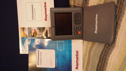 Raymarine st 70 display and manual(US $250.00)
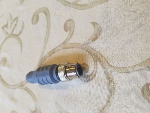 Lowrance nmea 2000 120ohm male terminator(US $18.00)
 Garmin gpsmap chart plotter 3010c(US $600.00)
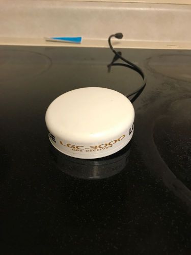 Lowrance lgc-3000 antenna with screws(US $100.00)
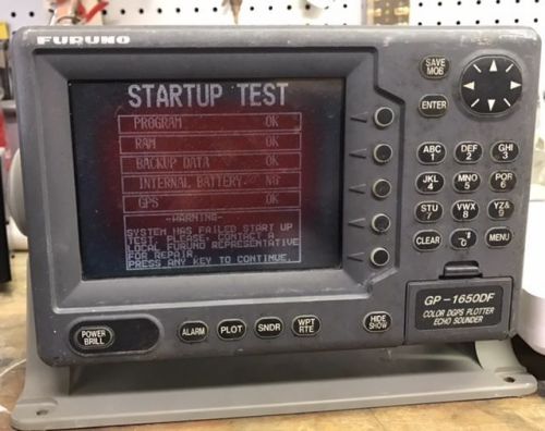 Furuno gp-1650df marine color gps fish finder chart plotter
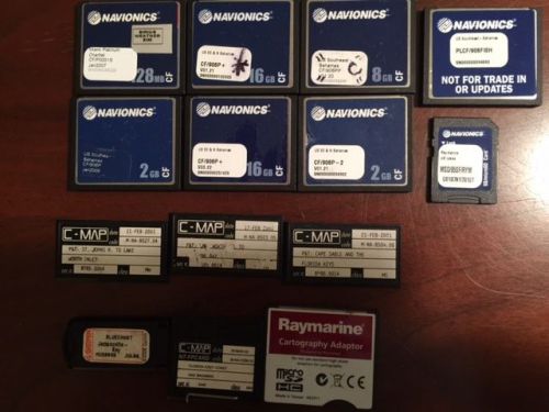 Lot of marine gps charts, navionics platinum, platinum plus, c-map charts(US $175.00)